Showing posts with label cycle routes. Show all posts

Friday, 18 September 2015

Cycling in Amsterdam and The Netherlands - The second edition of our guidebook!

There haven’t been updates on the Cycling Dutchman Blog for a while. This is not because I have run out of things to write, but simply because I have been very busy working on the second edition of our English-language guidebook about cycling in TheNetherlands. It is out now!

With the established demand for good, quality information in English about the cyclist’s paradise and knowing that the first edition of our guide would sell out autumn 2015, I set off about a year ago, asking myself how I could make the guidebook better.  How could I make the pack even more informative and how could I make best use of the available pages? Where could I make improvements on the established routes and what were those world-class destinations not yet on the itinerary?


One thing that really had started to bother me about the first edition of the book that it was really exclusively about cycle touring from one accommodation to another, not catering for those who just like to do day rides from one accommodation. At the same time, when making my regular visits to Amsterdam, I noticed an explosion in the availability of bicycle rentals in the city. Where there were about five rentals catering for tourists about five years ago, there are now nearly fifty!


This all has to do with the increased popularity of Amsterdam around the world as one of those cities you want to visit once in your life. Flights are cheaper than ever before and if you have London, Paris, Barcelona, Berlin and Rome on your wish list, Amsterdam is easy appearing on it too. The only problem with Amsterdam is that its historic World Heritage canal belt city centre is only a couple of square miles wide, where other European capitals have much larger city centres, capable of “storing” many more tourists.


Within 15 years, the number of international visitors to Amsterdam has doubled from 4.5 million per year to 9 million visitors per year, with the number of available hotel rooms growing from 16,000 to over 26,000 in the same period. The public space where the visitors wish to roam remained the same though, causing stress on the existing infrastructure. In Amsterdam, locals call this the Disneyland Effect. There is serious concern that Amsterdam’s City Centre starts to become like a 24 hours theme park, not a place to live, work or to do business.


With the City of Amsterdam and the government of The Netherlands now actively seeking ways to attract tourists away from the Amsterdam historic canal belt to other highlights of the country, and at the same time many people still flocking to the Dutch capital, wouldn't it be neat to use the bicycle to get people to explore beyond the obvious and to provide multiple day rides from Amsterdam’s Central station, all with their own themes and sights and all truly showing what the Dutch cycling culture really is about?  


This is how I came about to create six Amsterdam day rides for my new book, all with flexible distances to cater for everyone. Still starting and ending in the historic canal belt, the routes truly show you the great Dutch capital at its best, keeping you away from the rushed locals as much as possible. The green oasis within the city, such as River Amstel, Vondelpark, Westerpark and the Amsterdam Forest (“Amsterdamse Bos”) are all part of the pack, such as are the mighty trading ship “Amsterdam”, Artis Zoo, the Olympic Stadium, Amsterdam’s famous multi-storey bike park fietsflat, the stunning Rijksmuseum cycle tunnel and the sublime NEMO-rooftop (with the very best city views).
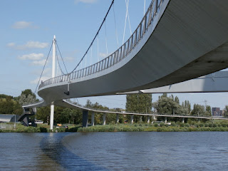


If you like design and architecture, you'll enjoy the rides in the revived eastern docklands. Surprisingly green is North Amsterdam, very close to the city centre and trending with the locals as a desirable place to live. In West Amsterdam, the book takes you to its garden cities and on the south side of the city centre you can experience Amsterdam's Expressionist's building style from the 1920s.  


The Amsterdam day rides also leave the city boundaries to explore Amstelland and its patchwork of scenic waterways, superb Muiderslot Castle, the straights of the busy Amsterdam-Rhine shipping canal, World Heritage Sea Fort Pampus, the old Waterland seawall with magnificent views over Lake Markermeer and last but not least, the popular Zaanse Schans windmill reserve. Altogether, the Amsterdam rides in the book cover a distance of 232 kms (143 miles) of routes; good for a great week of relaxed cycling from one accommodation only!


Of course, the original framework of the first edition of the book is still present in the second edition. There is so much more to The Netherlands than just Amsterdam and our Randstad Circle Route is in many respects a Best of The Netherlands Route, showing you as many aspects of the country as possible within a reasonably small distance. The 337 kms (208 miles) circular starts and ends at Amsterdam Central Station, but also connects to all ferries from/to the United Kingdom. With a route from/to Amsterdam Schiphol Airport included in the book too, you can now truly start cycling straight away, whether you arrive by plane, ferry or train. 


A main feature of the Randstad Circle Route is the excellent tarmac cycling highway through the sand dune reserves of the Dutch coast, providing continuous access to Holland's sandy beaches. The city of The Hague features the country's seat of government and some world-class museums. At Scheveningen, with its stylish Kurhaus, The Hague can easily compete with English seaside resorts as Brighton and Blackpool. Other seaside towns on the route are Katwijk, Noordwijk and Zandvoort. Away from the coast, Haarlem, Utrecht, Gouda and Delft have all scenic medieval city centres with historic canal lay outs and great shopping opportunities. 


Of course, the book couldn't miss out on the Dutch tulip fields. A section of the Randstad Circle is especially adapted to be utilised as a day ride from Amsterdam when taking bikes on trains. We did something similar for World Heritage Kinderdijk Windmills (missing out in the first edition), so you can choose to access this special area as a day trip from Amsterdam (again taking bikes on trains) or as part of the Randstad Circle Route. Other highlights of the Randstad Circle are the River Vecht, the Green Heart, a new route through the City of Glass, Holland's lowest lands (6.7 meters below sea level) and the world's largest steam engine.  


The Randstad Circle should easily cater for another week of relaxed cycling fun. If this wasn't enough, the second edition of the book also keeps featuring the Northern, Eastern and Southern routes of the first edition. These routes all link with the Randstad Circle (and thus with Amsterdam) and provide another 428 kms (264 miles) of routes; good for a third week of great cycling! These routes provide further variety on what the Netherlands has an offer. Utrecht Ridge National Park, the River Rhine, the famous Delta Dams, the world's largest reclaimed island and even some real Dutch hills are part of the pack, bringing the total length of routes in the second edition to a staggering 1,064 kms (656 miles)!


So, how was it possible to include so many more routes in the book? Well, I decided to completely redesign the book, making much more effective use of the available page space and also to rewrite all text. In the new book, the 125 maps (with multiple scales for urban and rural areas) are still at the heart of the navigation, but the many directions in the first edition have truly reduced to those which are essential. This has resulted in less fluff and greater clarity! You can see an example of the new design of the pages here. There are more examples shown on the offical website.


Another important content improvement is the facility listings. In the second edition of the guide, you'll find that the number of listed venues is doubled from 150 to 300, now all with full contact details, such as address, phone numbers and website URLs. Besides hotels, B&Bs, hostels and camp sites, bike shops and bike rentals are now included too! Just for Amsterdam, we now show the 25 most conveniently located bike rentals!


Last but not least all general information in the book is also completely reviewed. Besides chapters about the special cycling-minded traffic rules of The Netherlands and the cycle route signage systems, the second edition also puts the history of the Dutch cycling culture in a wider context. With the international interest in the Dutch cycling world at an all time high, the available information is growing by the day. The guidebook provides a great summary of the Dutch cycling story and also pinpoints you towards the best further background reading sources. 


Altogether, I regard Cycling in Amsterdam and The Netherlands as my best guidebook yet, providing an outstanding pack of information and routes, all in a format that easily fits on your handlebars in a standard bag or cycle map. It is not only good for on-the-road, but also provides great prior-to-the-trip planning fun and can serve as a treasurable long-term memory to a great experience. Given the fact that the book provides three weeks of cycling fun, it could even serve you for three one-week holidays! The GPS-tracks download pack also ensures that all routes of the book can easily be cycled with Navigation App of your choice. If you order the book via www.cyclinginholland.com you'll receive the GPS-tracks pack at no extra cost. 

The book with 164 full colour pages (page size 225 x 120 mm), spiral/wiro bound and the electronic GPS-tracks pack costs £18.95 for deliveries within the United Kingdom, £22.95 for deliveries in all other EU-countries (including The Netherlands) and £24.95 for deliveries world-wide. Find out more and order the book via www.cyclinginholland.com. Retailers interested in stocking the book should be in touch with our distributor Cordee (ISBN 9780957661714). 

What about another great guidebook by the Cycling Dutchman?

The London - Land's End Cycle Route Book is designed for those who LOVE cycling, but don't like traffic. The book takes you onto the most beautiful cycle routes of southern England, including the Camel Trail, Devon Coast to Coast Route, Bristol and Bath Railway path, Thames Valley route and many more! What makes the book unique is that the route is completely continuous, including detailed directions and local knowledge all the way. Get inspired; choose your favourite route sections or go for a full summer holiday adventure; 164 pages, colour, wiro bound, fits in standard handlebar bag, see http://www.london-landsendcycleroutebook.com.

Other popular Cycling Dutchman blog articles:

Explaining Dutch cycling infrastructure:


Dutch bike rides and Dutch cycling culture:

Dutch style bike rides in the United Kingdom:

Sunday, 1 March 2015

Cycling around the English Channel with the Tour de Manche

With the spring in the air, you may fancy heading out with the bike on my London-Land’s End Cycle Route. If you find Land’s End in Cornwall "a bridge too far" though, you may want to look into the great new traffic-calmed cycle touring opportunities southbound towards the English Channel. With our Skip the Exmoor Hills Offer it is easy to take in the gentle Devon Coast to Coast Cycle Route to Plymouth, where the London-Land’s End Route connects to a wealth of new route choices.


Let me introduce you to my friends Roy and Jacqui Gisborne of Signpost Cycling. Roy and Jacqui (on left in this picture) are pioneering cycling tourism in Dorset and have developed a similar guidebook product as “London-Land’s End” for the coastal route between Plymouth and Weymouth/Poole. Their Tour de Manche pack provides great mapping through the Sustrans Cycle City Guide series and reliable information in their 16-pages guidebook.


This product takes you in nine stages from Plymouth to Poole, with opportunities to take a ferry to France in Plymouth, Weymouth and Poole. If you have completed the Devon Coast to Coast with my London-Land's End Route in Plymouth, I’d recommend taking bikes on the train to Exeter as the section between Plymouth and Exeter still takes you partly on busy main roads (NCN 279). From Exeter, you can then comfortably join Roy and Jacqui’s pack. The brand-new Exe Valley Trail (see picture) is simply amazing and takes you quickly to the Jurassic Coast from where the Tour de Manche fun truly starts.    

Although very hilly, this route section to Bridport is truly traffic-calmed, providing you with amazing views and fabulous hidden attractions, such as the Donkey Sancuary, Beer Quarry Caves and the Seaton Tramway. Near scenic Dorchester you’ll also cycle via the famous Hardy Monument before having the choice to cycle either to Weymouth or Poole. If heading to Weymouth, you’ll have panoramic views over Chessil Beach and Weymouth, as Roy and Jacqui show in this picture.


So, what about the routes on the French side of the Channel then? As you can see on the map, there are various Tour de Manche route options possible. In the January issue of the Belgian Cyclelive Magazine, Cycling Dutchman Teus Korporaal explains how the routes on the French side are well signposted, but that you may need additional local maps to work out the individual stretches of the route. 


The only product describing the French side in English is the Petit Tour De Manche guide by Mark Porter. Similar to our London-Land’s End guide and the Tour de Manche pack by the Gisbornes, this book covers visitor information and accommodation suggestions for the section between St Malo and Cherbourg. It includes cycling via famous Mont St Michel (see picture, courtesy of Tour de Manche). The route section Roscoff-St Malo is not covered by this guidebook.  Except some broad information on the official website, detailed info about this section seems to be currently unavailable in English

In summary, I’d like to conclude that the international Tour de Manche project has opened up a wealth of new cycle touring itineraries, previously under-explored. On the official Tour de Manche website you'll find general useful information about all individual route sections. Some great products are available to help you cycling individual shorter sections of the route. It is unfortunate though that there is no product available that covers the full 1200 km network and that some route sections are likely to remain sketchy in the years to come. 


In this respect, the latest publication by (again!) another Cycling Dutchman Kees Swart should serve an inspiration. His independently produced Cycling around the Channel-books are a brave attempt to map all the available cycle routes around the English Channel. It is currently only available in Dutch, but I am confident it will be published in English by a fellow cycling tourism pioneer in the future. 

All Tour De Manche products in summary:

Tour de Manche - Cycle Route Guide Pack Plymouth - Poole by Roy and Jacqui Gisborne; guidebook of 16 pages in full colour, two Sustrans Cycle Maps and GPS-tracks pack, £ 19.95, see also www.signpostcycling.co.uk/routeguide.

Petit Tour de Manche - Cycle Route Guide St Malo - Cherbourg by Mark Porter, paperback guidebook, 168 pages, also including the English section Weymouth-Poole, £ 11.99, see also http://www.baytreepress.com.


Cycling around the Channel (Fietsen rond het Kanaal - Dutch) by Kees Swart,  two guidebooks of both 172 pages, colour, wiro bound, fits in standard handlebar bag, includes GPS-tracks pack, € 19.50 per book, see http://recreatief-fietsen.nl/fietsenrondhetkanaal/.


London - Land's End Cycle Route Book by the author of this article, connects Dover to Plymouth via London, Bath and Bristol, includes the Devon Coast-to-Coast route and also makes cycling to Poole possible; the ultimate product to access the Tour de Manche by bike! 164 pages, colour, wiro bound, fits in standard handlebar bag, includes GPS-tracks pack, £ 15.99, see http://www.london-landsendcycleroutebook.com.

Other popular Cycling Dutchman blog articles:

Explaining Dutch cycling infrastructure:


Dutch bike rides and Dutch cycling culture:

The 12 best bike rides of The Netherlands

Dutch style bike rides in the United Kingdom:

Thursday, 8 January 2015

“I just didn’t know this was here!” - The relevance of signage

“I just didn’t know this was here!”


I hear this line regularly from locals while doing cycle route surveying work. Completely surprised about the presence of a cycle route, he/she then also often states he/she “lived here for twenty years”. It painfully shows how many British people hardly ever explore their own area on foot or bike beyond the merits of the main through roads. Rushing off by car, they just don’t have a clue about other ways to get from A to B.


We also notice this when we teach Bikeability to school children. When taking them out and about on local routes near their school, we hear many boys and girls often declaring that “they have never been here before”. This is pretty sad, given the fact we are often cycling within a one mile radius from where most children live.


In my opinion, beyond all the problems and limitations of UK cycle routes, the lack of proper signage is an issue which needs great attention. To get a country back on bikes, you need to show clearly in the field, in the public eye, where cycle routes are and where they will take you. Only this will truly encourage people to explore beyond what they know. Free cycle maps, on-line routeplanners and just that occasional sign as pictured here are all well intended, but generally only serve those who are already on the look out.


In The Netherlands, the authorities only know this too well. To keep the masses on the move by bike, grant visual signage, dedicated to cycling only, is available at every relevant junction. You’ll be clearly directed to common destinations. It is such signage which made me explore locally myself when I was just an eight year old boy; it definitely stopped me of becoming obese at young age!

Just by seeing people using these well signposted routes, other people get inspired to do some local exploration too. This is visible in the UK to some extend in places where new cycle routes are created, but increase in participation in walking and cycling could be so much higher if signage as a tool was taken really seriously.


It still surprises me how councils spend millions on the creation of a new cycle route, but then fail to signpost it properly. In the scheme of things, good signposting is very cheap. With many UK cycle routes not being obvious and hidden away from the main road network, these routes need a towering visual presence on the streets to get known by its potential customers. 


Clear destination signage dedicated to cyclists has been present for a long time in The Netherlands. It all started way back with the so called “mushroom signs”. These signs have indeed the shape of a mushroom. Placed at low-level and with reasonably small print, they provide a wealth of information to the cyclist, with distances to destinations even highlighted in 100m intervals. You can still see these “mushrooms” forming impressive networks in holiday areas where leisure cycling is very popular, such as on the Dutch coast and on the moors in the east of the country.


For day-to-day journeys, white signs with red lettering clearly show the most direct way from A to B. These are really the cycling equivalent of the green destination signage on UK main roads. As a driver you are completely accustomed to a system in which once the name of a town appears on a sign, you’ll be fully directed to the town in question. In that respect, Dutch cyclists receive the same treatment as drivers, and with towering results. At least one in four journeys in The Netherlands is made by bicycle, while in the UK, the poor “one if fifty journeys” figure still prevails. Lack of continuous quality destination signage on existing cycle routes is in my view part of the problem.


Clear and consistent signage is an essential part of the Dutch cycling success story. A good example of the efforts by local authorities is the development of the Rotterdam Regional Cycle Network. Back in the 1990s, Wim van de Poll of UrbanDynamicLabs developed the concept of numbered cycle routes for commuters, in an attempt to bring more clarity in the spaghetti web of existing cycle routes.


Van de Poll came up with a clear network for Rotterdam cycling commuters, building bridges across borders of various local authorities. Work on implementation of the network started in 1995 and was completed by 2010. All commuter routes of this network are clearly branded. Beyond the obvious route numbers, Van de Poll also insisted that every route should have clear destinations in all communications, making it always obvious to any user what the route is about.


You might think that the London “Cycling Super Highways” are signposted in a similar way, but if you have a closer look, there is really not very much about it beyond the obvious blue sway of paint on the tarmac. I don’t intend to discuss the general poor quality of the “Cycling Super Highways” at this point, but it is obvious that its signage doesn’t meet “Dutch standards” either.  Signposts are still isolated features and are not present at every relevant junction.  Also, signposted secondary routes to destinations nearby are often limited to a "one sign only". Once you have left the "super highway" you are pretty much on your own. Compare this with the map of the Rotterdam network, where all secondary routes are fully signposted as well!


In some aspects, the London "Super Highway" signage is already better then the average signage of the National Cycle Network. The London posts give at least an idea about destinations and travel times. This is often lacking in the National Cycle Network-signage (see picture left). I truly have the impression that the majority of the population still doesn't have a clue what is hiding behind those little blue signs with red route numbers... 

The New Forest National Park has been working beyond the NCN-network and has created another number-based system. It is a network of numbered junctions, which are all clearly marked at these particular junctions. The signs have a bar code on the top of its wooden poles and by scanning the code with your phone, you’ll get a map on your screen, so you can work out where you want to head next…

This looks suspiciously the same as the Dutch “junction” network, on which junctions ("knooppunt") are also numbered and signposted as such. This network covers the whole country and is designed for exploring by visitors and locals alike, away from the Dutch "cycle path next to main road"-network and its direct routes. In the picture left, you are at junction 9 and you can immediately see how to get to junctions 6 and 10. Also important, an overview map can be found at every numbered junction, see the sign of junction 48 below. This is much more inviting to use and more visible for potential customers in comparison to the very minimal New Forest example with its dependence on high-tech smart phone technology.


Although hugely popular in The Netherlands, a junction network has its limitations. Van de Poll, the designer of the Rotterdam commuter network, has been out on his bike a lot and can tell you entertaining stories of lost cyclists, desperately asking him the way to, for example, “junction 48”. “Where do you want to go then?” Van de Poll normally asks in return, just to be replied with added frustration “to junction 48”. This shows how a system also can take over and how the relation to the real world can easily be lost.


In my opinion, there is a lot to be gained with continuous destination signage, making all those back streets routes (which so happily exist on cycle maps and on route planners, but nowhere else) visible. I was delighted to see  some new destination signs, as pictured here, popping up in my town of residence, Barnstaple, Devon. For me, these signs breathe something fresh and new. Also, the smaller font then usual gets pretty close to the style of the Dutch mushroom-signs, meaning it is possible to show multiple destinations on one sign. The reasonably small size of the sign doesn't make the sign taking over its surroundings and still has a great clarity.

Of course, these new signs are isolated and are still failing to form a network (there is a total of three of such signs!). Its design is great though and I feel this could be the way to clearly signpost local backstreet routes to local destinations such as schools, railway stations, shops, housing and industrial estates, etc. Surrounding villages within a three mile radius, should not be forgotten either, as these routes have a great cycling potential.

Together with my local campaigning group, the North Devon Cycling Forum we hope now to inspire the local authority to expand this destination signage and to create a network such as shown in the map in the real world, visually present in the public eye. Of course, there are many routes which still need fixing. But if they are ready to go (even with some shortcomings), routes should get properly signposted.

A visual presence truly inspires people to explore and might allow millions of people to say virtually at the same time “I just didn’t know this was here!”


You don't need proper signage if you use a high quality "Cycling Dutchman" guidebook!

Cycling in  Amsterdam and The Netherlands - The very best routes in the cyclist's paradise makes you travel beyond Dutch cliches like clogs, windmills and the Amsterdam red light district, allowing you to truly explore the lowlands. The book features 1064 kms of routes and has special chapters explaining the unique Dutch cycling-minded traffic rules and its cycle route signage systems; 164 pages, colour, wiro bound, fits in standard handlebar bag, see also http://www.cyclinginholland.com.

The London - Land's End Cycle Route Book is designed for those who LOVE cycling, but don't like traffic. The book takes you onto the most beautiful cycle routes of southern England, including the Camel Trail, Devon Coast to Coast Route, Bristol and Bath Railway path, Thames Valley route and many more! What makes the book unique is that the route is completely continuous, including detailed directions and local knowledge all the way. Get inspired; choose your favourite route sections or go for a full summer holiday adventure; 164 pages, colour, wiro bound, fits in standard handlebar bag, see http://www.london-landsendcycleroutebook.com.

Other popular Cycling Dutchman blog articles:

Explaining Dutch cycling infrastructure:


Dutch bike rides and Dutch cycling culture:

The 12 best bike rides of The Netherlands

Dutch style bike rides in the United Kingdom:


Older Posts Home